

by David Merkey | February 13, 2020
As a young wetland professional, I remember the excitement of my first wetland delineation. I got out in the field with my supervisor, learned new plants, explored the colors in the Munsell chart, learned to squint to see that slight difference in the shades of green where the sedges gave way to grasses indicating a change in soil/hydric conditions, and took soil probe after soil probe to narrow down just where that upland/wetland dividing line was that meant so much to our client.
As the years went by, I began to lose count of the number of delineations I did. Between the summer heat, the mosquitos, ticks, poison ivy, and the curtains of greenbrier that just happen to be growing right across that upland/wetland dividing line, the luster began to fade off the diamond wetland professional trying to properly document what they were seeing in the field. But, the thought of delineating to find that magic line, the spot where the special combination of all three wetland indicators (hydrology, hydric soils, AND hydrophytic vegetation) occurred so that impacts to that special area could be avoided or minimized while everything else got paved, left me…disillusioned, to say the least. That wasn’t what I went to school for (I’m sure I’m not the only person who has ever thought that). Despite this, I still looked forward to getting out of the office but wanted to be excited about being in the field again.
Then I came to GreenVest and the excitement came back.
The excitement returned because performing a wetland delineation for an ecological asset development project is completely different than doing a wetland delineation for traditional development. Under traditional development, you find that line on the landscape where the three criteria start to appear together, then you hang your flags, bring in the survey team, calculate your impacts, fill out your applicatio, and obtain a permit (if it’s a poor quality wetland full of headcuts and invasive species, that just makes it easier!). The next thing you know, bulldozers will soon be on the way.
However, when you’re doing a wetland delineation as part of an ecological asset development project, finding the magic line where you finally have all three wetland criteria is only a portion of the reason you’re on this site. What you’re really looking for and interested in is where the line is not, and why. You’ll ask yourself questions like: “If the line is here, should it be? Was it always here? Where could it be if we did ‘x’ or if we did ‘y’?” As you look around and notice your position in the landscape, the mixed plant community around you, the current and historic land uses, the dry colors of the remnant hydric soil profile five feet up the side of the sandy, vertical incised stream bank, you’re no longer as concerned with just where the three indicators overlap, but you want to know which indicators you’re ultimately going to find.
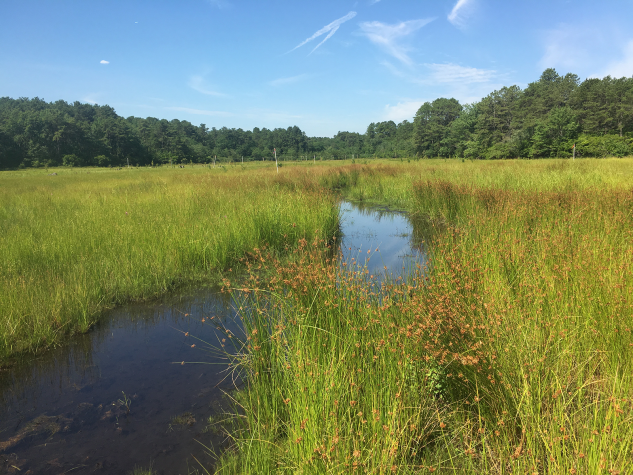
Once you identify the wetland, you also need to assess it, understand its potential functions and values, assess how well it is performing those functions, how well could it perform them, determine what stressors are contributing to the observed conditions on the ground, and what can we do to mitigate them. Are the stressors affecting this area also affecting others, which ones, and how? What’s even more exciting is finding the areas that no longer have all three wetland criteria currently, but probably once did. For example, as you look around a forested floodplain with large sycamores, river birch, and silver maples in the canopy, multi-flora rose and bush honeysuckle in the understory, and soils that have diffuse, faded grey and orange colors, you get to play detective. Not only do you travel through time to see what has changed, but you get to hypothesize results of what could change.
Visualizing the world through the lens of ecological asset development changes the way you approach a site as you head into the field. Instead of focusing purely on the limits of what is there now, you think about what could be. How much ecological uplift can we create, how much habitat, how much better can we leave this particular spot on the planet?
Of course, in the world we live in today, we also need to perform and think in practical terms. How much will the design, permitting, construction, maintenance and monitoring cost? How many wetland or stream credits can we generate? How will we document the functional and ecological uplift? What other resources are available that we can leverage? The answers to these questions may vary depending on the desired results, which could range from increased water quality, improved habitat, resilient communities, satisfied clients, or a better legacy.
Vision, Performance, Results—that’s GreenVest and that’s exciting. Contact us today to learn more about wetland delineation.
This post was written by Senior Project Manager, David Merkey.

