

Implementation of the Waynesboro Stream Restoration Project is well underway! This project is restoring 5,192 linear feet of streams and associated floodplains in Virginia’s Potomac River watershed. GreenVest, in partnership with Environmental Quality Resources (EQR) and Stantec, is completing this project for the benefit of the Virginia Department of Transportation (VDOT). Construction began in September 2022, and will be completed in July 2023.
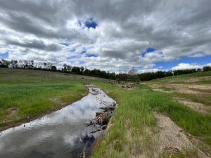
The project team identified this site in Waynesboro, Virginia, as a prime candidate for restoration. The pre-construction condition was characterized by open cattle pasture. Lack of trees in the riparian zone combined with direct cattle access to the stream and increasing impervious cover in the drainage area contributed to increased erosion rates, poor water quality, and poor habitat onsite. The restoration was designed to improve water quality and habitat by eliminating erosion, reducing nutrient loading, and restoring in and near stream habitat features, including a wooded riparian buffer.
The primary techniques used to stabilize the stream include grading streambanks to a stable slope, restoring natural planform, and planting native riparian vegetation along the banks and adjacent floodplains. Construction is also adding complex habitat by using large woody material in stream and floodplain structures, expanding and enhancing adjacent wetlands, and improving floodplain connectivity. In total, the project is restoring 5,192 linear feet of streams and enhancing 12.7 acres of riparian buffer within the floodplain through permanent conservation easements. The ultimate result will be a fully functional and self-sustaining forested stream system.
Our Certified Remote Pilot, Jack Turner, was on site earlier this spring to document the construction progress and used a drone to show completed parts of the site, the active construction zone, and stream channels that will soon be restored. The use of a drone helps our team and stakeholders visualize construction progress and can provide broad context to inform technical approach, design, and construction. This technology can be used to create digital elevation maps, assess vegetation cover and composition, or create stunning aerial images to show the before and after conditions on restoration sites.
We tip our hard hats to our great team and can’t wait to share more updates throughout the project’s maintenance & monitoring period!


